This guidance covers the key requirements of data to accompany Development Plan Approval (DPA) applications.
Development Plan Approval is a free service that checks development plans and deeds and identifies issues before the registration of individual plots.
Data format and content
CAD data submitted with a DPA application must be georeferenced to the British National Grid (OSGB 1936) and submitted in DWG format. Individual components should be clearly labelled in ‘layer properties’.
View further guidance on digital data.
You should also provide a PDF version of the data. This will allow for a quick visual inspection of the development, and will form the basis of the approved plan we return to the solicitor and publish on our website.
Below is an example of a PDF plan, complete with approval docket, ready for return.

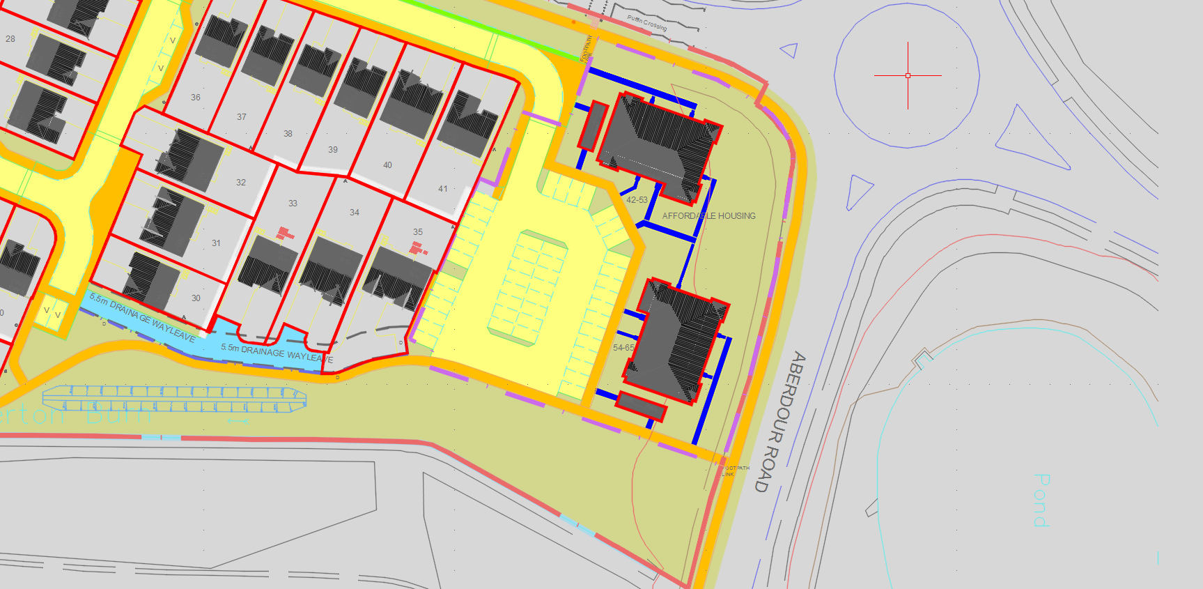
Where applicable, the data must contain the legal extent of:
- development boundaries
- individual house plot boundaries
- individual flatted properties
- plot numbers
- parking spaces with plot numbers
- common footpaths or driveways
- service strips
- open spaces
- affordable or registered social landlord housing
- substation or gas governors
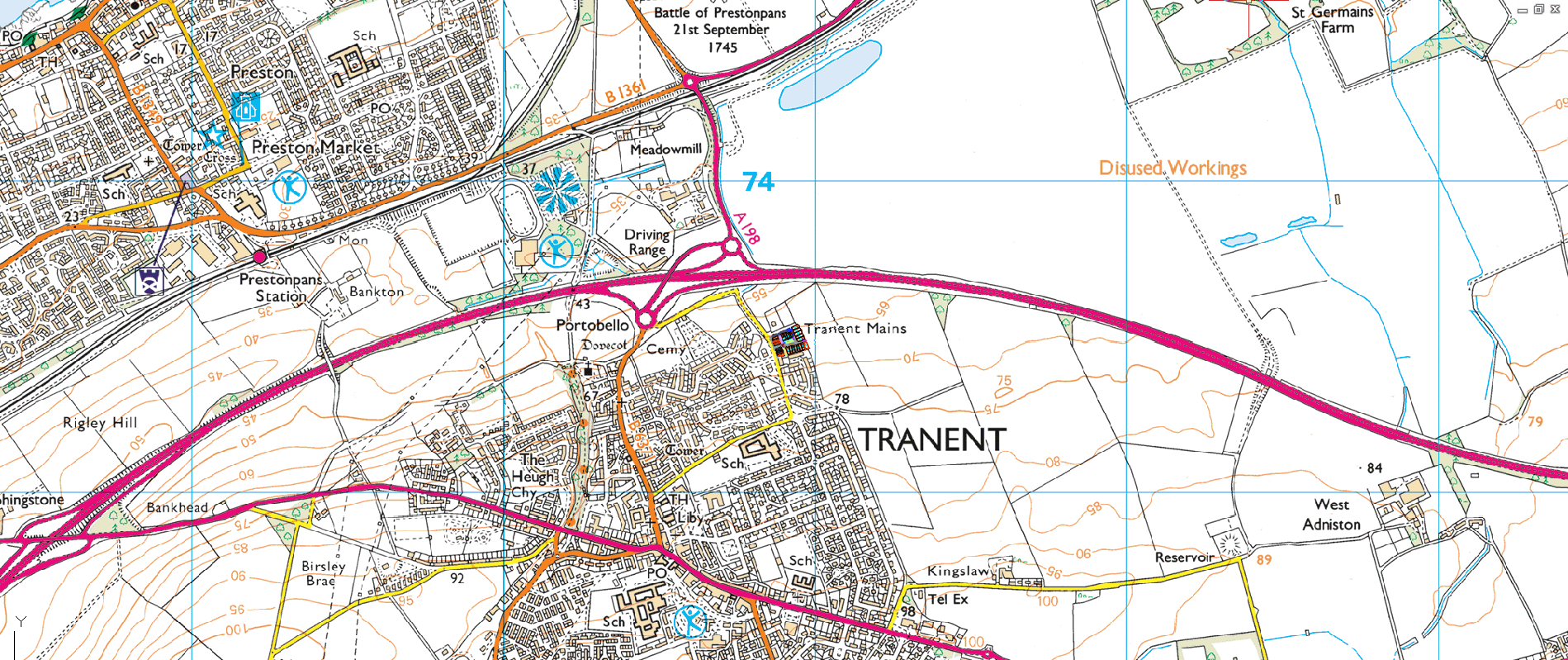
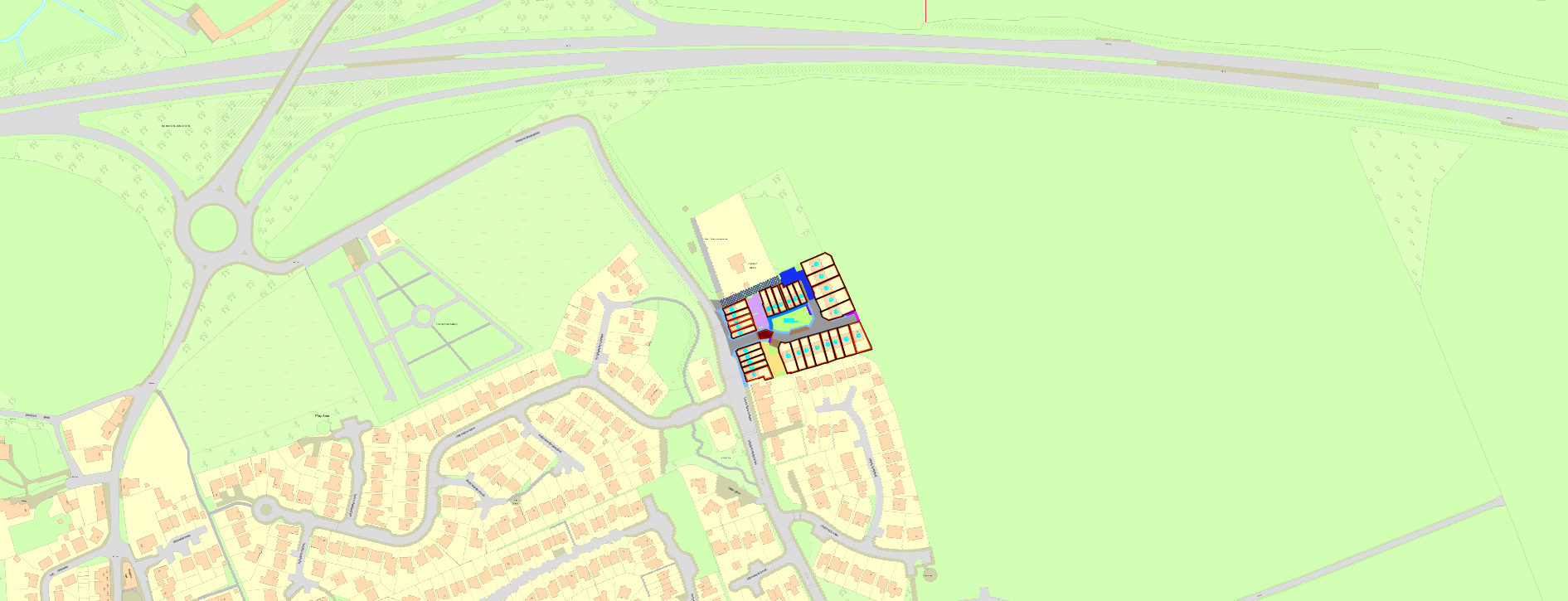
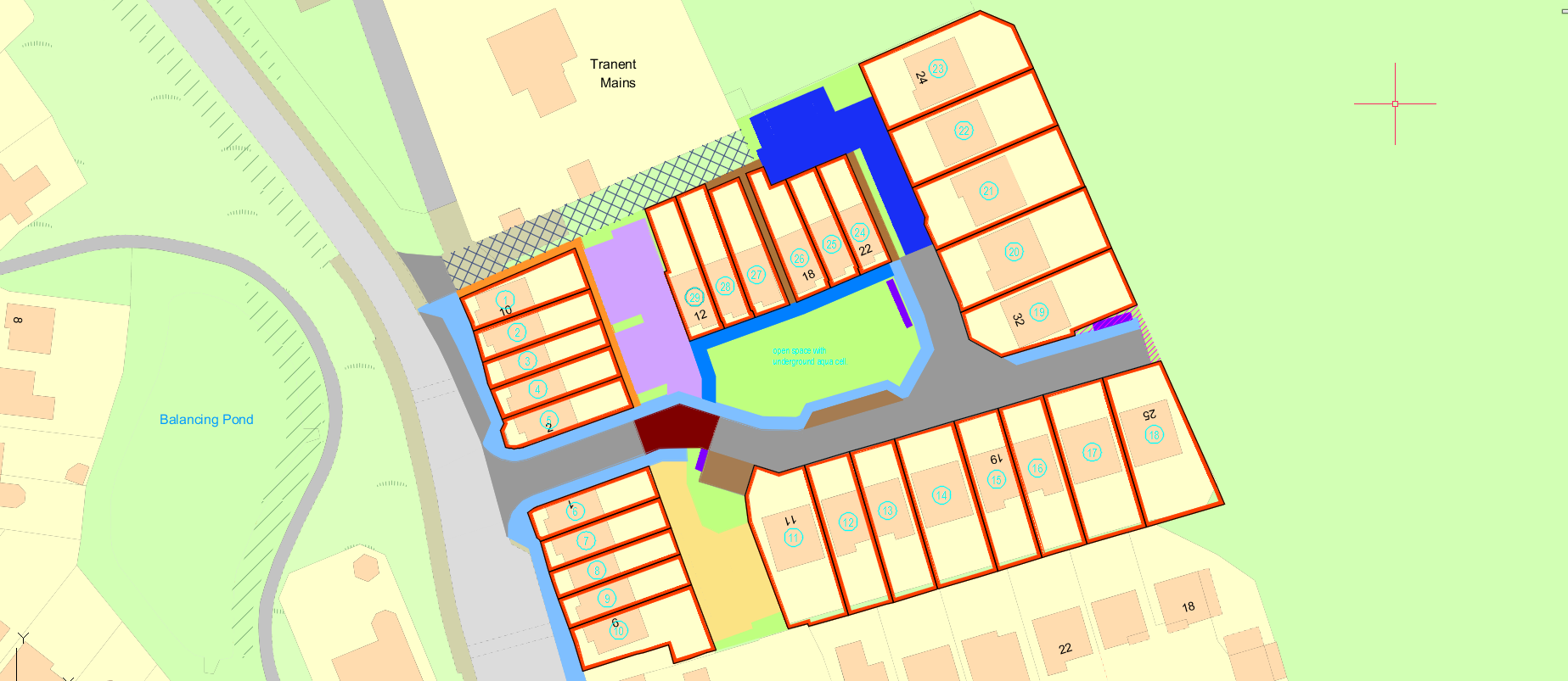
The below example shows CAD data georeferenced to the national grid co-ordinates. The data has been imported with the Ordnance Survey map as the backdrop, and is positioned in its real-world position, to ensure that the accuracy of the data is maintained.
Approximately 1/10000:
Approximately 1/2500
Approximately 1/500
Layer management
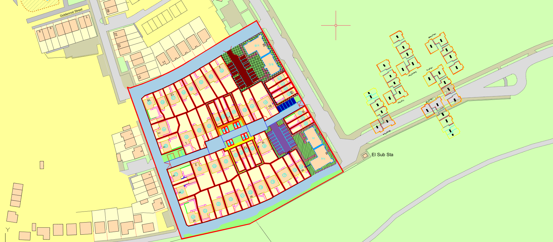
The below example highlights a suitable way of labelling the components within the data. This allows us to readily identify the components we need, while dismissing those that are irrelevant to DPA.

Flatted properties
Individual flats identified
If your default setup for flats is to show individual flat extents, your drawing should include floor level plans showing the position of the flat in relation to other flats on that level.
When you supply floor level data, you should present it so floor level drawings are rotated and scaled to agree with the main development drawing, and offset to the side, as shown below.
Individual flats not identified
If by default you don’t identify the precise extent of individual flats, your drawing only needs to identify the footprint of the block. See the example below.
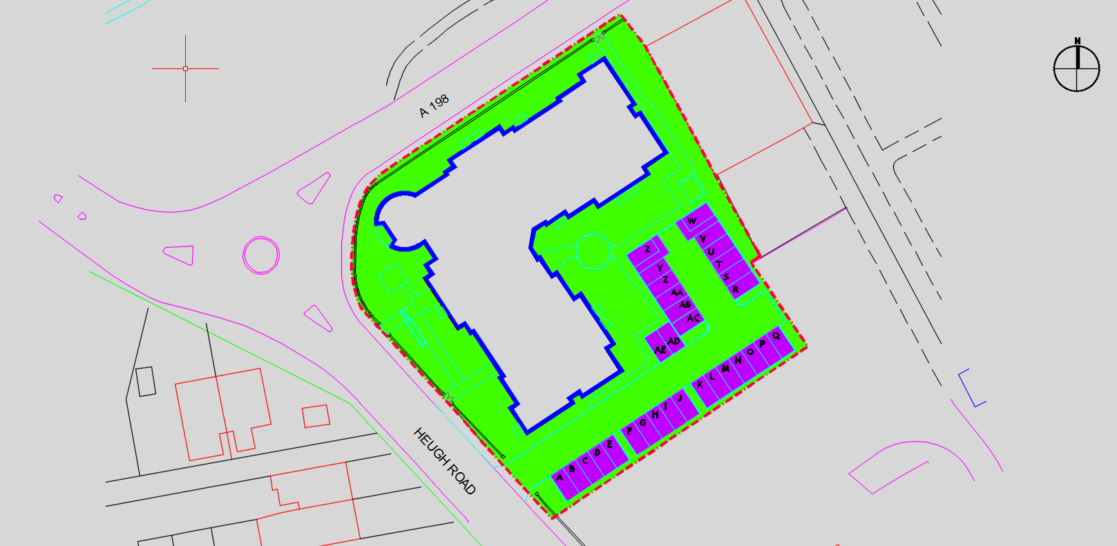
Tenement cadastral unit
We treat blocks of flats and all the flats registered within it as a single unit on the cadastral map. This unit defines the extent of the tenement steading. All flats, their rights and pertinents are contained in the tenement cadastral unit.
We can identify the extent of a tenement cadastral unit at the DPA stage. This will ensure a straightforward registration process, and means the developer will not need to provide the same information for each sale from the building.
In addition to the solum of the block in the example below, we can see:
- parking in purple
- paths in yellow
- open space in green
These areas clearly fall within the area delineated red on the same plan. This red delineation can be treated as the tenement cadastral unit.
View further guidance on tenement cadastral units.
Approved developments
You can view approved developments on our website.
A DXF or ESRI shapefile version of a registered title extent can be supplied upon request.
Social housing
We treat areas to be handed over as social housing as removed from the overall development. You don’t need to identify the blocks, floor levels or any elements associated with these areas. A block reference for the area to be transferred will suffice. See the example below.